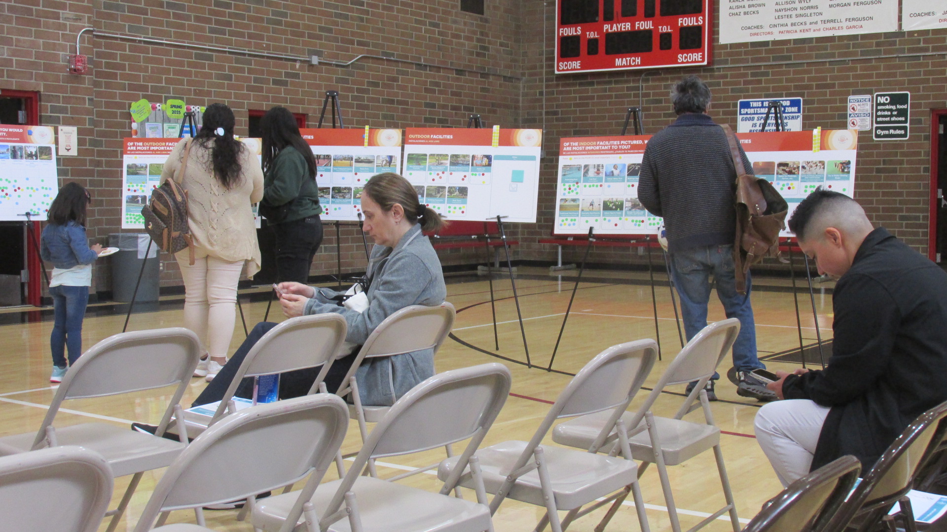
The City of LA’s parks are in trouble and they need your help. Lately I’ve been writing a lot about the City’s parks and the challenges they’re facing. The Department of Recreation & Parks (RAP) is aware of the problems, but at this point they don’t have the funding to invest in upgrading their facilities. One possible solution is a bond measure, but before the City goes that route, they want to get input from residents. That’s where you come in.
If you care about LA’s parks, get involved in the Park Needs Assessment. This is a process that will unfold over months. You can participate in community meetings, and if you can’t make the meetings there’s an on-line survey. Neighborhood Councils are also encouraged to submit comments. For more info, click on the link below.
I went to a meeting at the Victory Vineland Community Center in February. They had lots of colorful boards with graphics. The presentation was brief and effective. And there were plenty of RAP staff members there to answer questions and take comments. I came away feeling like they really wanted to hear from the public.
So don’t be shy. Go to a meeting. If you can’t make a meeting, do the on-line survey. Let the City of LA know what kind of parks and recreation facilities you’d like to see. This is your chance to be heard.
Following up on my recent posts about funding for parks in the City of LA, I wanted to offer an update on a recent action by the LA City Council. Because of the budget crisis that the City is currently facing, the Council is looking for ways to generate more revenue. Last week they approved a report from the Budget & Finance Committee which asks City departments to report back on a number of possible options, including a bond measure to raise funds for both the LA Fire Department and the Department of Recreation & Parks (RAP). They’re also looking at increasing the base funding formula for RAP in the City Charter. (It’s actually worth reading the whole report. Some of the options are interesting. Some are bound to be controversial.)
Park advocate Ron Bitzer, who serves as a volunteer on the City Park Advisory Board in North Hollywood, also sees a possible opportunity emerging as the City tries to rebuild after the recent fires. Bitzer has written an open letter to Steve Soboroff, who was selected to lead the recovery effort, where he argues that planning for more parks, and creating funding streams, should be part of the process.
In general, I think we should be making sure that open space, green space, and the urban forest are integrated into all of LA’s planning efforts. In recent years both our local and State government have worked to fast-track project approvals, in large part arguing that we just need to build housing as fast as possible. Unfortunately, this has led to the removal of more trees and the loss of more permeable surface area, which will make LA even hotter and drier. Instead of just rushing to build as much as possible, we should be planning to build healthy, sustainable communities.
UPDATE: This post was originally written prior to the LA City Council meeting on Feburary 21. The item about expediting projects for the Olympics was continued, and will now be heard on Friday, February 28. PLEASE NOTE: This meeting will be held at Van Nuys City Hall, 14410 Sylvan St. Van Nuys. You can also call your councilmember to express your views.
***
When the politicians at LA City Hall first approved hosting the 2028 Olympics, they said LA wouldn’t need to build new sports venues or new infrastructure. A post on the LA28 web site says that “The LA28 Games are designed to fit the city as-is [….]”. The talk was that this would be a “no-build” Olympics. The post goes on to say….
As a global leader in sports, entertainment and technology, LA is built to host large-scale, sustainable, global events that benefit everyone and will be the first-ever Games to not build permanent infrastructure. [Emphasis added.]
Well, anybody who believed that obviously hadn’t spent much time around City Hall. Now the LA City Council apparently wants to build a whole lot of new stuff, and they want to be able to build temporary and permanent venues, training facilities, broadcast and media centers, transit infrastructure, and other projects that could be associated with the Olympics or the Paralympics without having to receive planning approvals, obey zoning regulations, observe height restrictions or setback requirements, or any other regulations that could delay construction. You can read the language from the motion yourself. (Council File 15-0989-S47)
This is just crazy. But tomorrow, Friday, February 21, the City Council will likely approve this motion directing City departments to prepare an ordinance to make this crazy idea a reality. If the ordinance is approved, you can bet we’ll see a barrage of new projects being justified because they’re supposedly associated with the Olympics or the Paralympics. These projects will be approved with no public engagement and no environmental review. In other words, once they’re proposed, they’re approved. And don’t be surprised if they use this to greenlight Frank McCourt’s Dodger Gondola project.
In other words, this has gone from being the “no-build” Olympics to being the “no-plan” Olympics. It was pretty clear even before this that our elected officials were in over their heads. Now it seems they’re trying to dig themselves out by eliminating planning, eliminating environmental review, and cutting the public out of the process.
If you have something you’d like to say to the City Council about this, the best thing to do would be to show up at City Hall before 10:00 am tomorrow, Friday, February 21. (You can’t call in anymore, because Council President Marqueece Harris-Dawson doesn’t want you to.) If you can’t make it down there, I suggest you call your council office when they open tomorrow morning and let them know how you feel.
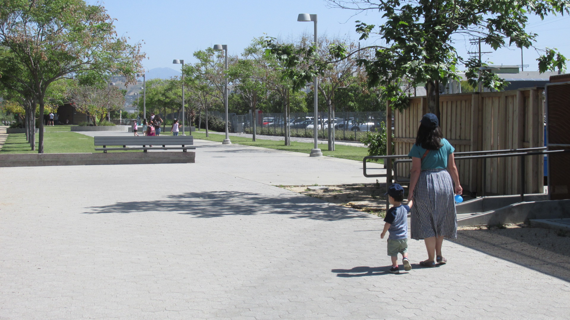
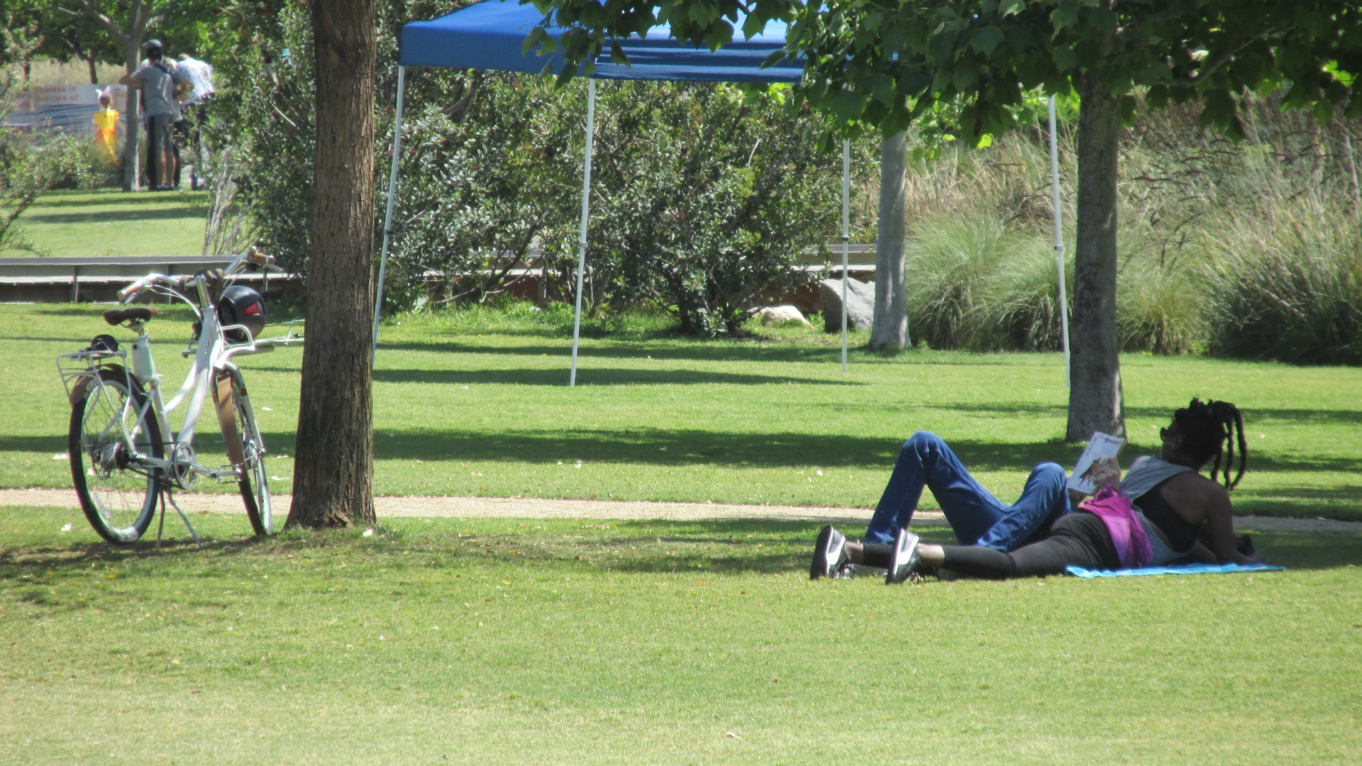
The LA Department of Recreation & Parks (RAP) has been underfunded and understaffed for years. While LA politicians talk a lot about the importance of green space and open space, when it comes to actual funding, LA’s parks seem to be a very low priority. Some of the city’s parks are well-maintained, but these tend to be in more affluent areas, where residents have access to additional funding resources. Many of LA’s parks are in bad shape because RAP doesn’t have the money or the staff to give them proper care.
One of the biggest problems for RAP is that it’s one of only two LA City departments that’s subject to the “full cost recovery program”, something that City Hall imposed when it was dealing with the 2008 financial crisis. This means that RAP has to reimburse the City for the cost of the water and power it uses, in addition to the cost of employee benefits. (The only other department required to do this is the LA Public Library, and they were able to mitigate the loss of funding through a ballot measure.) This means that RAP is paying tens of millions of dollars every year to cover these costs, which is a huge chunk of its budget. To give you an idea of what a drain this is, here’s an excerpt from a memo sent by RAP General Manager Jimmy Kim regarding the Department’s 2023-24 budget….
CHALLENGES: RAP is required to continue to use $98M (28.92% of the total operating budget) to pay reimbursements to the City’s General Fund for employee benefits ($64.7M), the Department of Water and Power (DWP) for utilities ($30.4M), and the Bureau of Sanitation for refuse costs ($2.9M). These increases diminish RAP’s ability to meet and increase vital maintenance and recreational programming needs. Since the inception of these Department contributions in FY ‘08-09, approximately $969M has been diverted away from RAP’s core operations.
So if you’re wondering why the playground in your local park is looking so worn out, or why the restrooms aren’t properly maintained, or why the pool has been closed for so long, there’s a good chance it’s because RAP doesn’t have the money to take care of these things. A 2018 Parks Condition Assessment Report recommended that 20 recreation centers be replaced because they were in poor condition, needing major retrofits and renovation. The same report recommended that 12 pool and bathhouse facilities be replaced because many of them were over 60 years old and had surpassed their expected service life. But more than six years later, much of that work has still not been done because of insufficient funds.
The people of LA need clean, well-maintained parks. It’s possible to provide the funding to accomplish that, but any effort along those lines needs to be open and transparent, with strong public engagement and careful oversight. I’ll be writing a follow-up to this post where I’ll talk more about how we can make that happen.
Proposed conceptual plan for Headworks Site Development Project.
When I first started this blog over a decade ago, one of the first things I posted about was the construction of the Headworks Water Complex on the LA River just north of Griffith Park. (I also posted a follow-up in 2028.) The project consisted primarily of two underground reservoirs that were built in response to Federal laws that prohibited storing drinking water in open reservoirs, but the LA Department of Water & Power (LADWP) is now moving forward with other components, including a water quality laboratory, a direct potable reuse demonstration facility, and a public park.
View of Headworks site from Forest Lawn Drive, looking north toward Burbank.
The first reservoir was completed in 2015, and the second in 2022. The public park was part of the original proposal, and I’d been wondering for years if it was ever going to happen, but in 2024 LADWP released an environmental study which includes the park proposal. It looks like it’s moving forward.
Another view of Headworks site from Forest Lawn Drive.
In addition to providing new recreational space, the proposed Headworks Restoration Park would provide facilities to educate the pubic about local ecosystems and water use. The centerpiece would be the gardens constructed on top of the West Reservoir. Currently the plan for the gardens includes a series of ramps, landings, and walkways along with groves of trees and bike paths. The image at the top of this post gives a general idea of what it would look like.
Top of reservoir protruding through landscape at Headworks site.
Right now LADWP is projecting that the park would be completed in 2028. Let’s hope it happens, but it’s important to remember that infrastructure projects have a way of dragging out longer than expected.
Back in 2017, I walked across the Fourth Street Bridge and took a bunch of photos, thinking it would be a great subject to write about on this blog. Now, only seven years later, I’m finally getting around to doing this post. What can I say? Time flies….
Fourth Place, leading up to the Fourth Street Bridge.
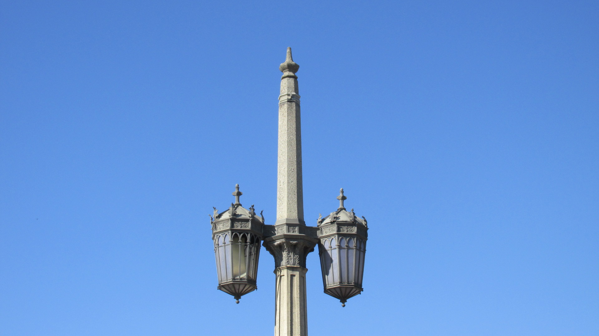
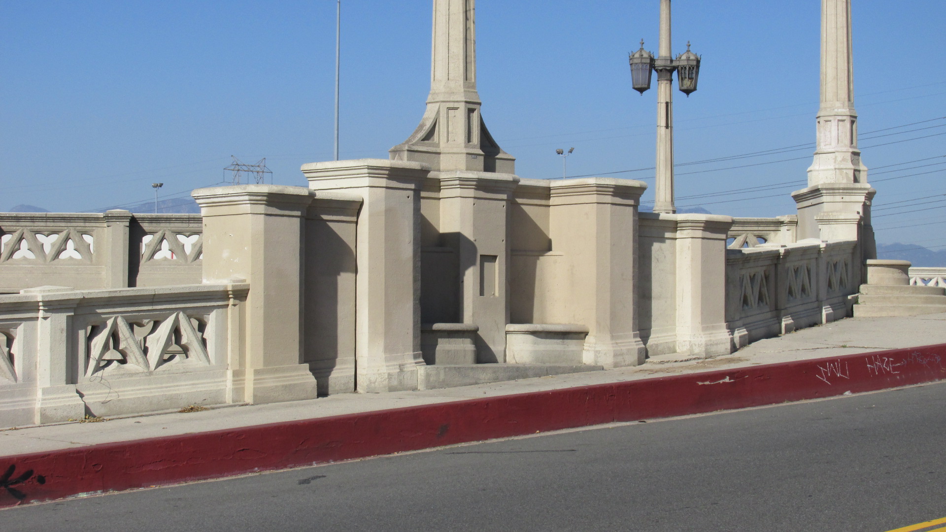
To my mind, the Fourth Street Bridge is one of the most striking bridges in LA. I don’t claim to be an architecture critic, but it seems like there was unusual amount of care put into the design. The streetlights, porticos and concrete railing were fashioned in a mix of Beaux Art and Gothic Revival styles that was carefully worked out by the architects. These aren’t just decorative elements that were tacked on. They’re well-suited to the scale and the massing of the bridge.
Fourth Place merges with the Fourth Street Bridge.The streetlights echo European Gothic design.Some of the piers feature built-in seating.
Constructed in 1931, the bridge was part of a massive investment in infrastructure made possible by the passage in the 20s of LA’s Viaduct Bond Act. (To show you how ignorant I am, I didn’t know until recently what the difference was between a bridge and viaduct. Apparently, a bridge is a small structure built to cross a fairly narrow river or ravine. A viaduct is a larger structure made up of a series of bridges that crosses a wide river or a valley. But I’m still going to call it the “Fourth Street Bridge”. Old habits die hard.)
A view of the bridge looking toward East LA.The San Gabriel Mountains to the north.Unfortunately, these days many of the porticos are filled with trash.
The Fourth Street Bridge was built by the LA City Bureau of Engineering under the supervision of Bridge and Viaduct Engineer Merrill Butler. Butler had a long career in LA, working for the City in various capacities until his retirement in 1961. Over the years the projects designed under his direction included the First Street (now Cesar Chavez) Bridge, the Hyperion Bridge, the Figueroa Street Tunnels and the Hyperion Sewage Treatment Plant.
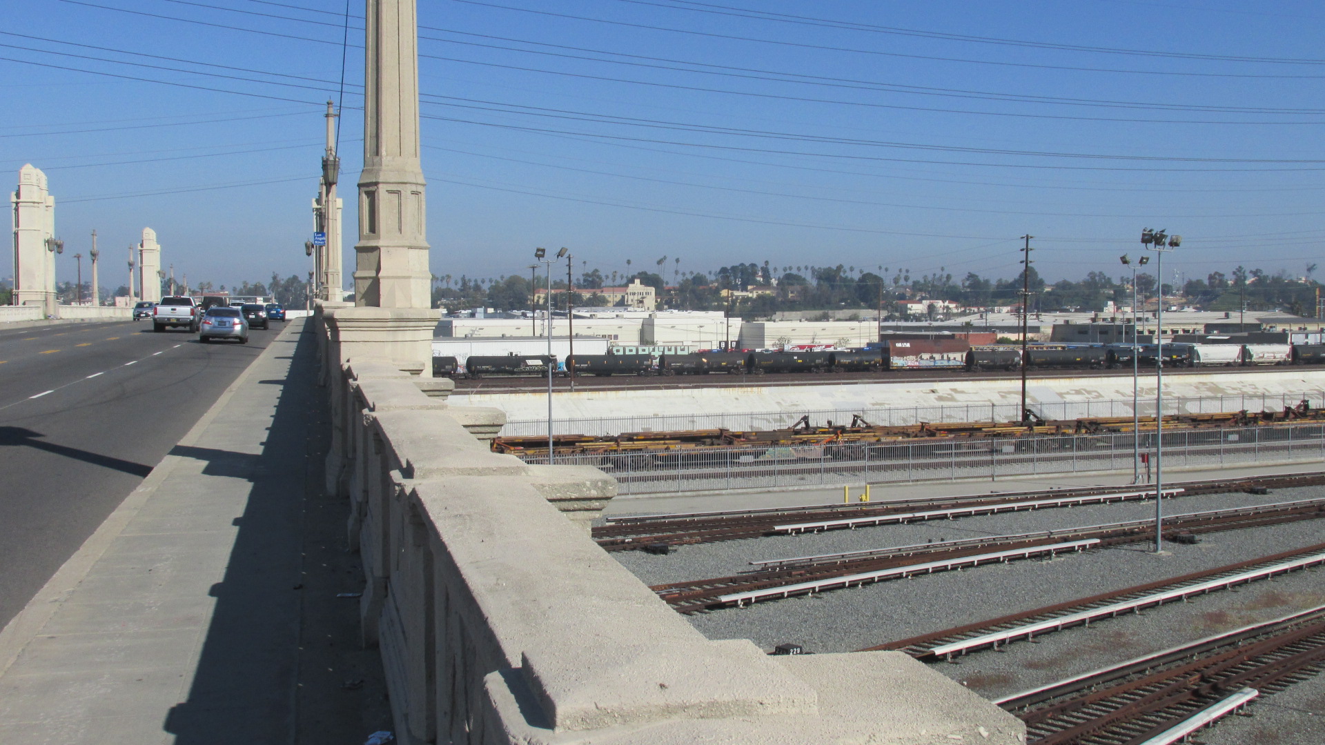
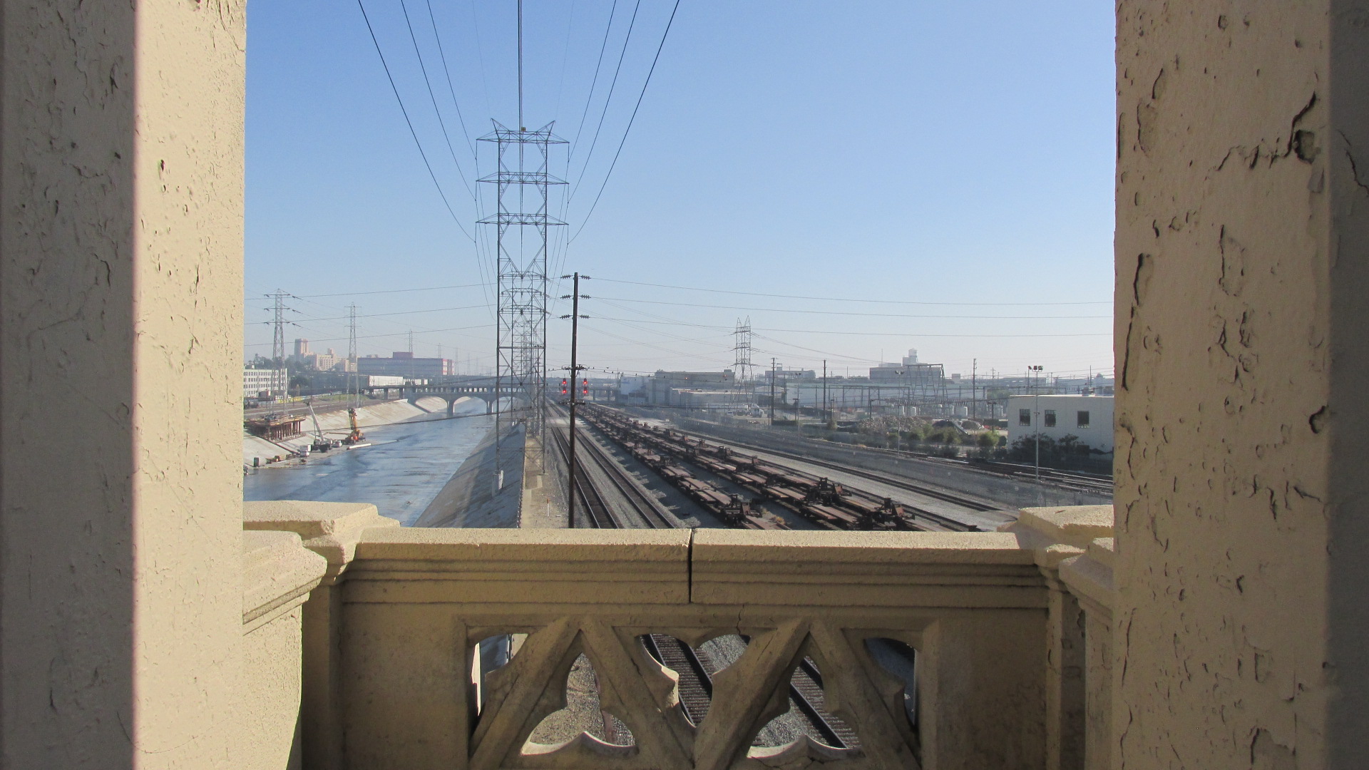
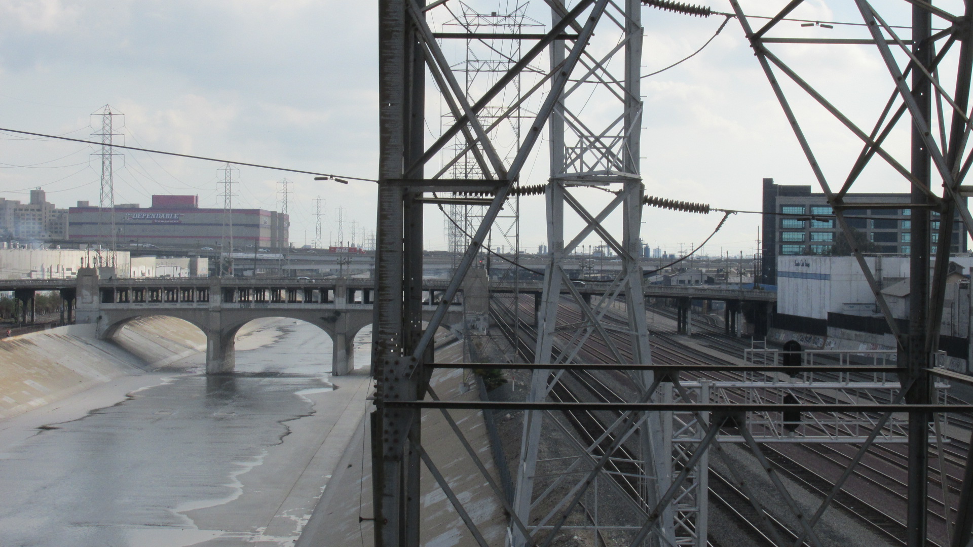
The series of bridges that connect East LA to Downtown are part of a massive infrastructure nexus that played a key role in LA’s growth. In the latter part of the 30s, work began on the flood control projects that would shape the LA River as we know it today. One of the reasons for encasing the River in concrete was to protect the rail lines that ran adjacent to it. You couldn’t move goods without trains. And rising above the concrete channel is a vast network of power lines.
Rail lines next to the LA River.Miles of power lines run above the River.Rows of flat cars lying on the tracks below.
In 1995, the Fourth Street Bridge was retrofitted to bring it into compliance with current seismic safety standards. And in 2008 it was declared a Historic Cultural Monument by the City of LA.
The Cesar Chavez Bridge lies just north of the Fourth Street Bridge.Looking west toward Downtown.
Here are a couple of links, for anyone who wants to dig a little deeper. Thie first will take you to Water & Power Associates, which has a number of historic photos of the Fourth Street Bridge. And if you’re into LA history, check out the Museum tab in the index on the left. Their virtual museum offers an amazing collection of images and information.
And here’s a brief bio on Merrill Butler that was apparently written at the time of his retirement. Not surprisingly, it’s pretty superficial, but it also seems to offer a small snapshot of mid-century LA. A different time, a different culture.
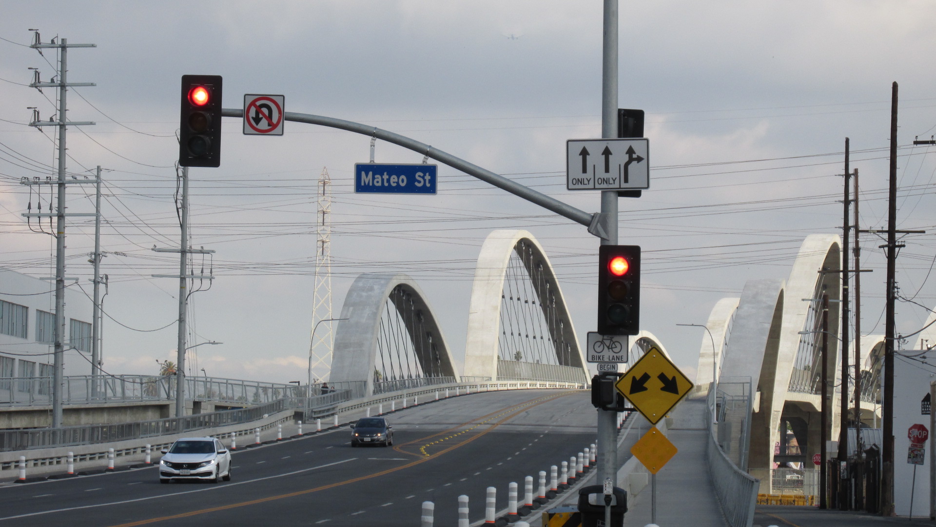
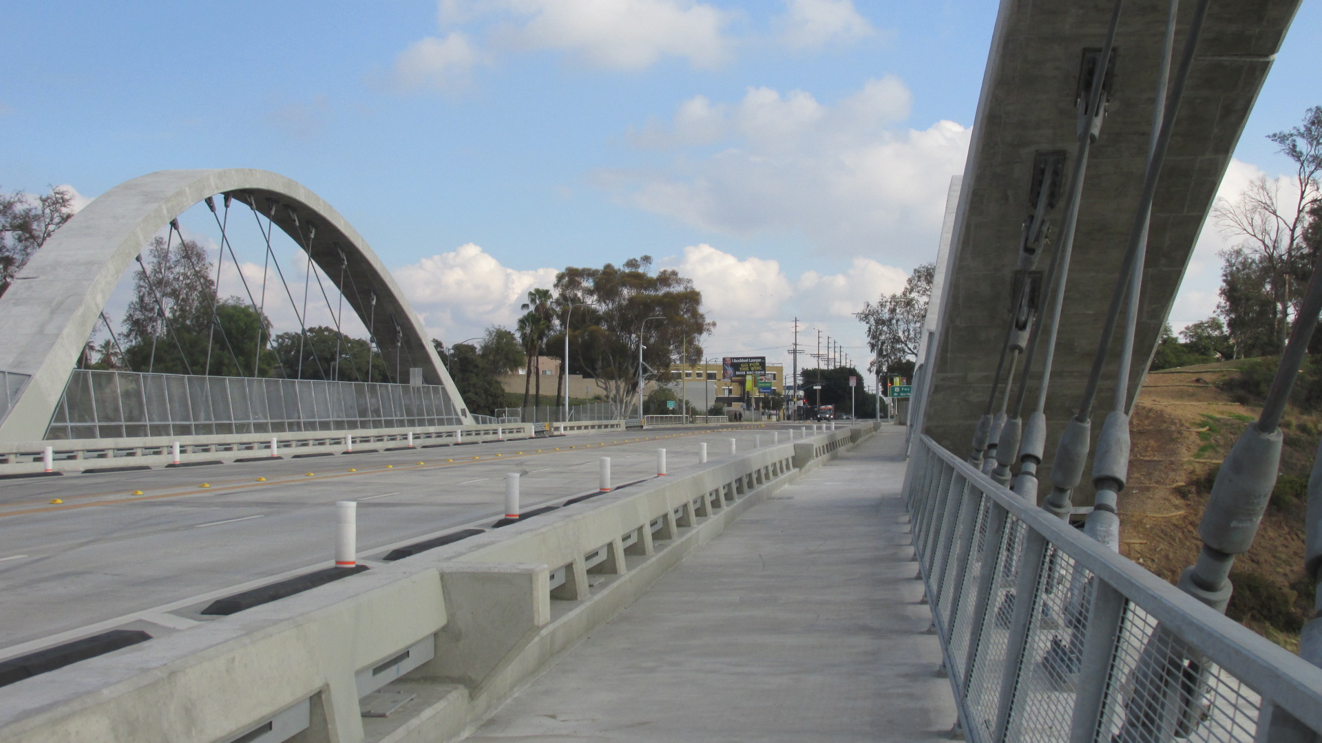
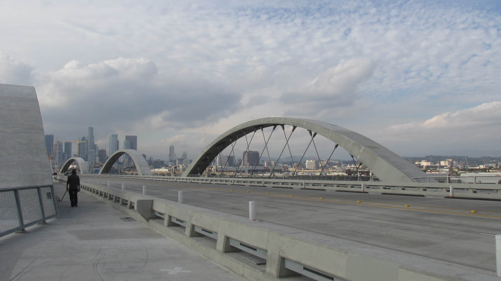
A view of the Sixth Street Bridge from Mateo Street.
The new Sixth Street Bridge opened in July of this year. The first few weeks were pretty chaotic, with drivers doing stunts, daredevils climbing the arches, street artists getting creative with spray paint, and more. Things got so bad the LAPD ended up closing the bridge just to keep a lid on the mayhem. Scenes of crashes, fireworks and people partying were making the nightly news.
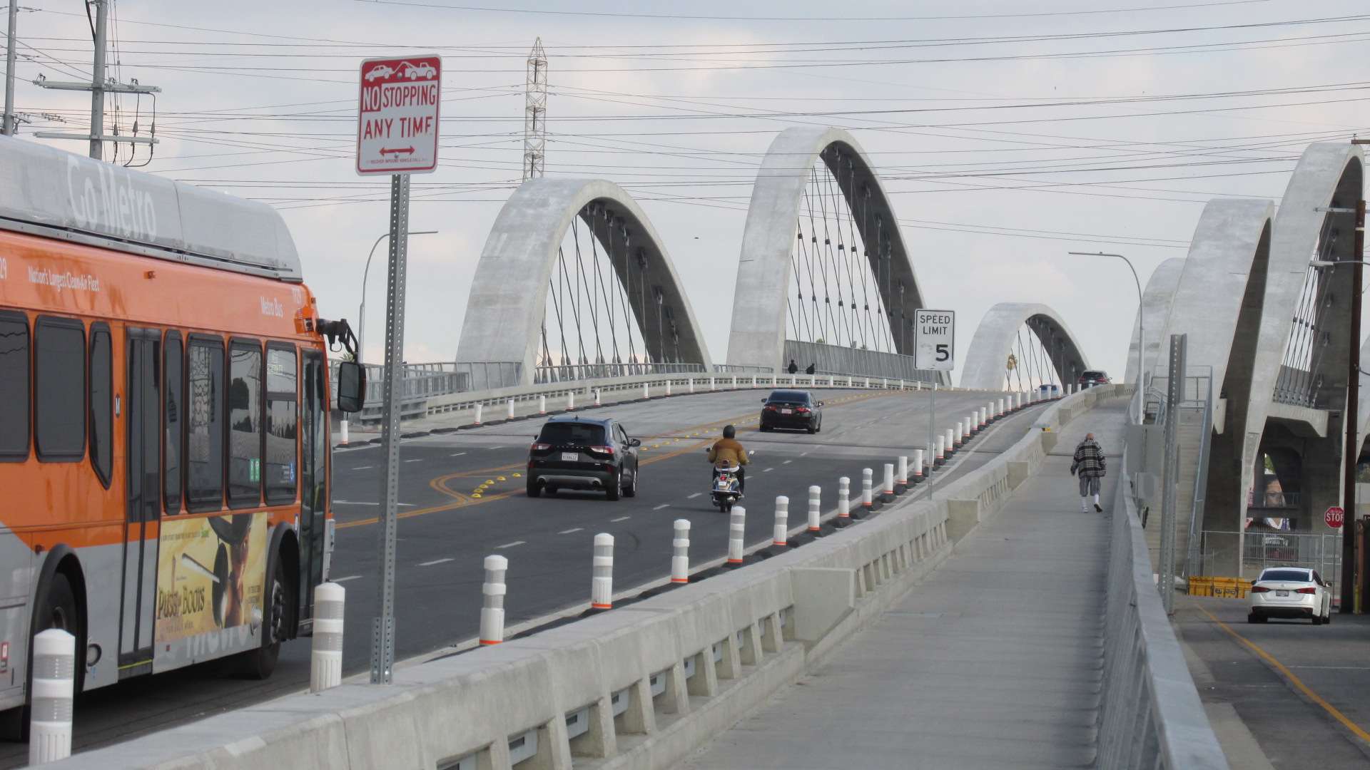
Starting across the bridge from the Downtown side.
But now all the chaos seems to have faded away. When I took a walk across the bridge earlier in December, there wasn’t much traffic and I saw only a handful of pedestrians. It was a cool, cloudy day, and things seemed pretty peaceful.
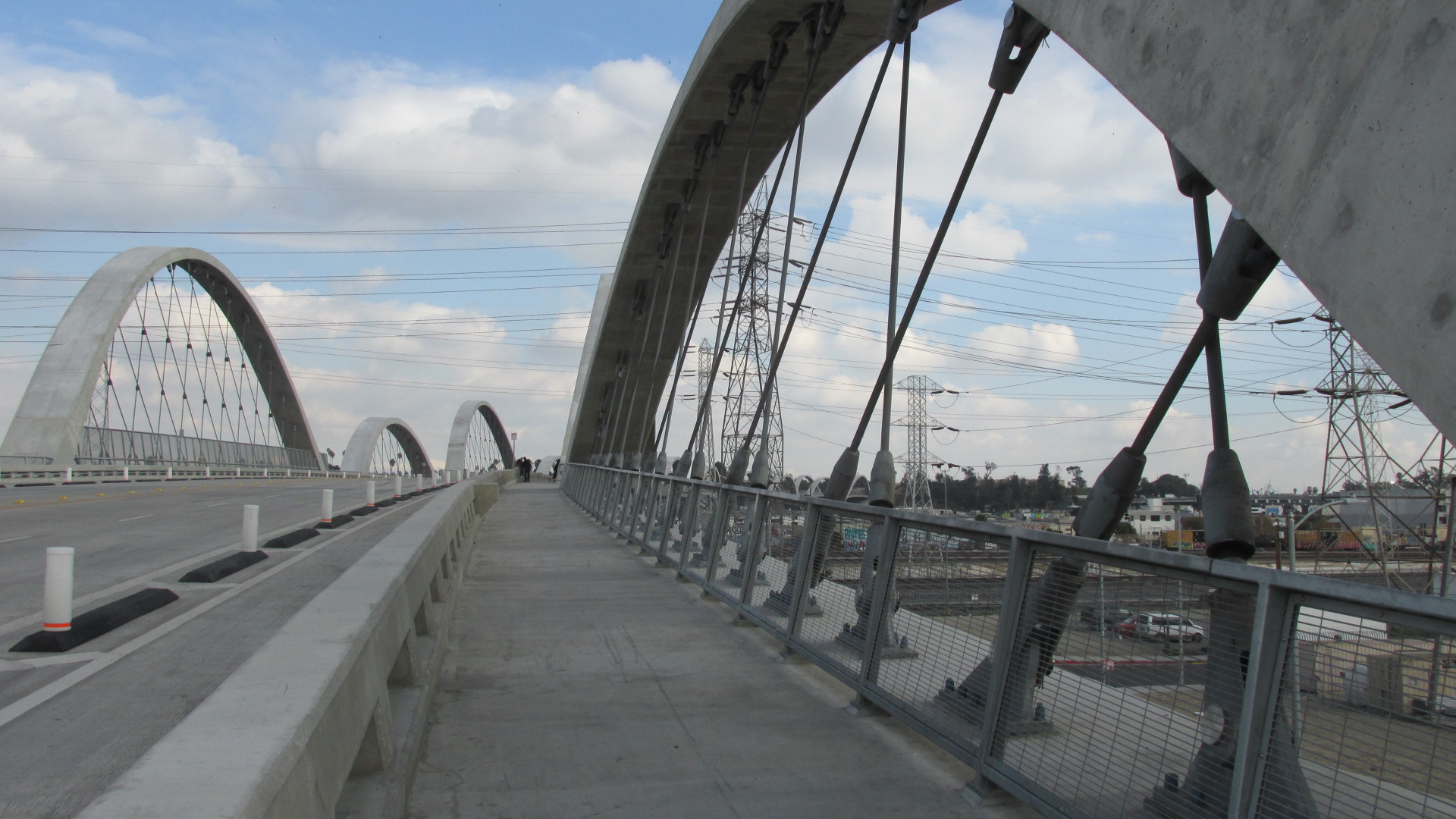
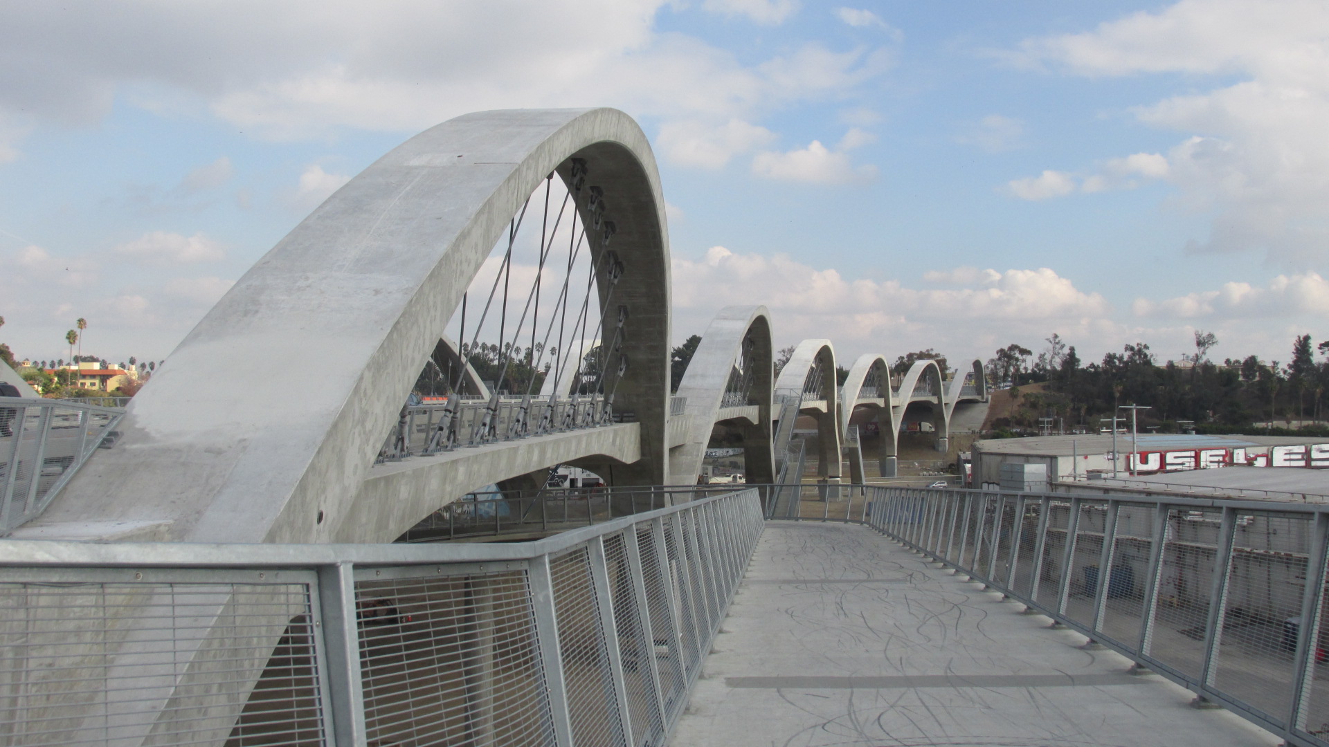
The bridge’s arches create a sense of energy.
I have mixed feelings about the Sixth Street Bridge, which I’ve written about previously. In this post I want to focus on the positive. The bridge really is beautiful. The design, by Michael Maltzan, is impressive, with the fluid lines of the arches rolling off to the horizon. Walking across you get a sense of being lifted into the air, with stunning views of LA’s various landscapes surrounding you on all sides.
The new Sixth Street Bridge is actually a replacement for the previous version, which was built in the early 30s. It’s just one of a series of bridges that run across the LA River between Downtown and East LA, including the Cesar Chavez Bridge, the Fourth Street Bridge, and the Seventh Street Bridge. All of these were built in the first half of the 20th century.
A view of the Fourth Street Bridge.A view of the Seventh Street Bridge.
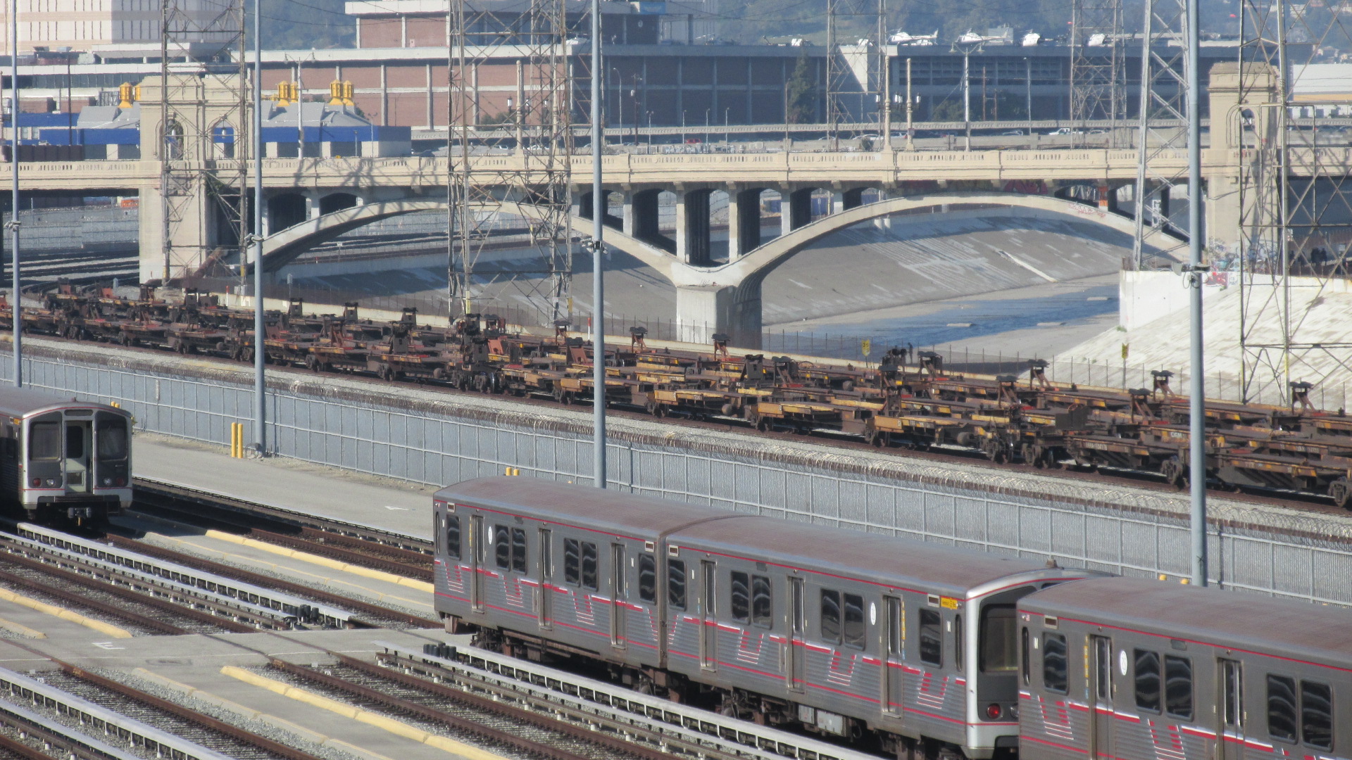
As you can see from the photo above, this area, which borders Downtown LA, is criss-crossed with multiple layers of infrastructure. Aside from the bridges, you have the concrete surface of the LA River, rows of train tracks, and miles of electric power lines, all surrounded by a massive industrial district.
The arches rolling off to the horizon.
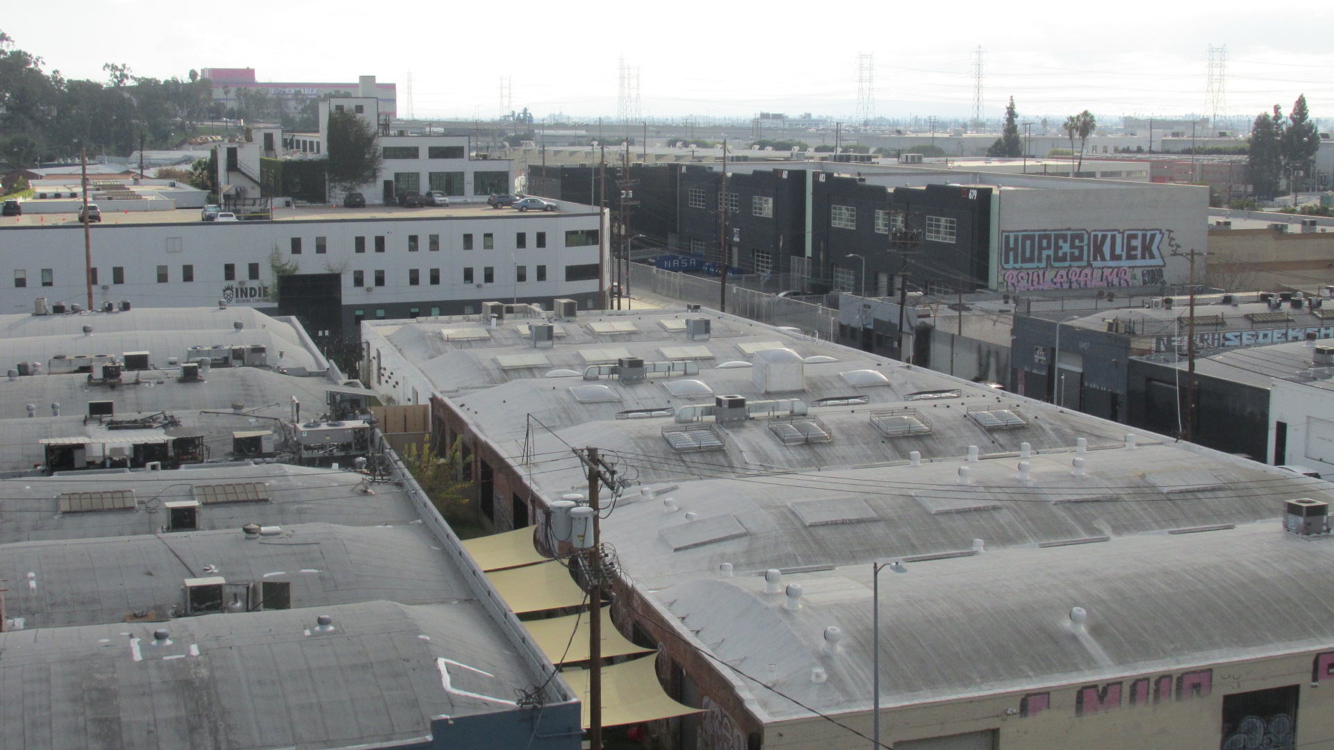
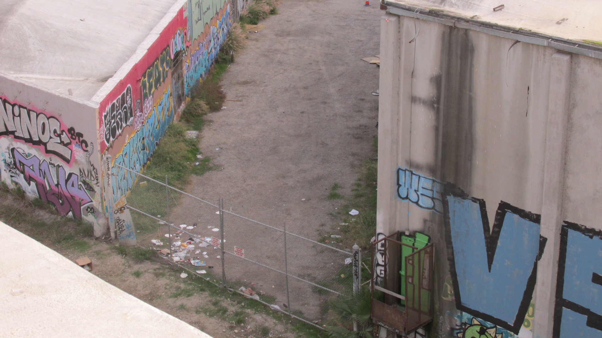
Beneath the bridge you can see scores of large, nondescript buildings which were built for manufacturing and storage. These days you’ll probably find that a number of them have been converted to ghost kitchens and cannabis greenhouses.
A view of the industrial district that lies below the Sixth Street Bridge.Scores of drab buildings cover the landscape.
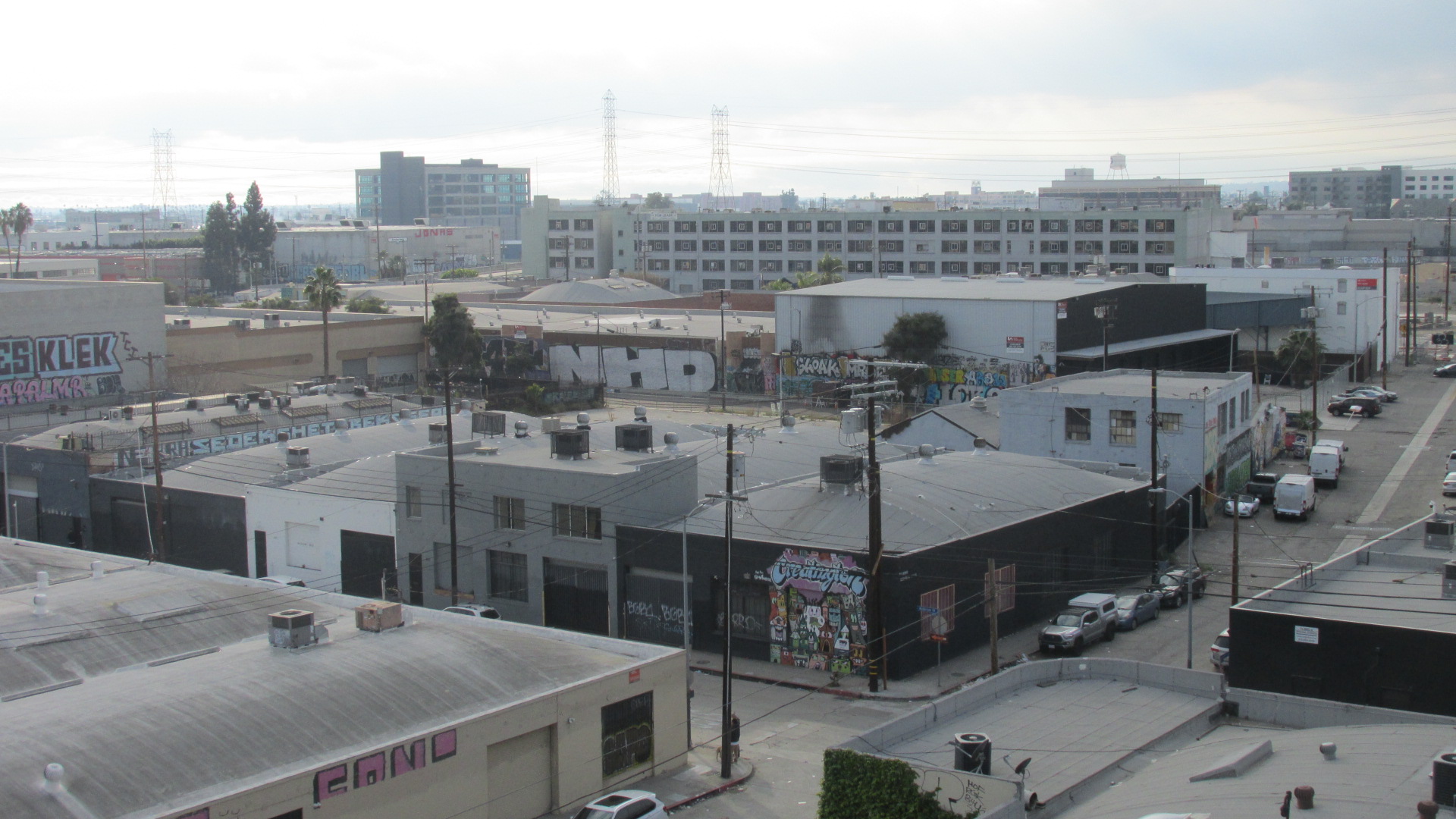
Nestled inside this vast maze of commercial buildings you’ll often come across pockets that seem neglected or deserted. These spaces are a magnet for street artists that love the expansive, windowless exterior walls.
The desolate spaces between these buildings draw street artists……who love the wide, windowless exteriors.
Coming down on the other side of the bridge, Sixth Street becomes Whittier Boulevard, which is lined with shops and restaurants serving the working class community of Boyle Heights.
The bridge lands in Boyle Heights.
It will probably be a long time before we can really see the impacts caused by the new Sixth Street Bridge. There’s been lots of hype about the upside of this new LA landmark, but it’s also likely to accelerate the waves of gentrification and displacement that have been sweeping across the city. Property values have already risen in Boyle Heights, and so has the number of evictions.
Like I said, though, for the moment I’ll focus on the positive. It is a lovely bridge.
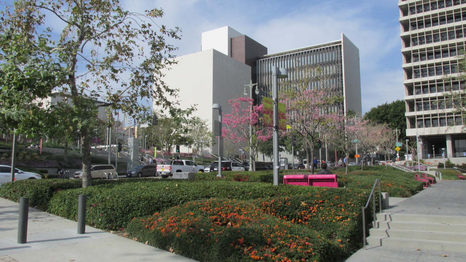
The pandemic wasn’t really over in April, but a lot of people, including me, were tired of being shut up at home. I wanted to get out into the world again. I’d been thinking for a while about paying a visit to Los Angeles State Historic Park on the outskirts of Downtown. I finally just got on the train and headed down there.
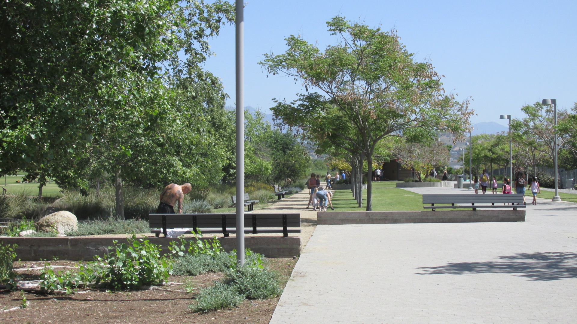
The park has been a work in progress for over a decade. I wrote a post about it in 2014, when many people still called it The Cornfield. Back then it was mostly just grass and dirt. Since then, it’s been transformed into a well-manicured open space….
It certainly seems popular. On the day I showed up there were plenty of folks enjoying the park, and it’s not hard to see why. It’s impeccably landscaped, with gently curving paths winding through the grass, and rows of beautiful trees. There’s a good-sized field for those who want to get a game going. It seemed like the crowd was mostly younger, with a number of moms and dads and little kids.
It also seemed like the crowd was mostly made up of relatively affluent millennials. I have no hard data on where they came from, but I suspect that many of them live in Downtown. If that’s the case, they’d have to be making fairly good money. The listings on Apartment.com show that most of the studio apartments in the 90012 zip code start around $2,000, with one-bedrooms going for between $2,500 and $3,000. Rents at the Llewellyn, a fairly new building just across the street from the park, go from $2,450 to $5,155.
The City has had a good deal of success in luring people to Downtown, but let’s face it. Downtown is not open to everybody. If we go with the standard assumption that you’re supposed to spend about a third of your income on housing, you’d need to make $72,000 a year to afford a studio apartment in the area. A small family would probably have to have a combined income close to six figures just to get into a one-bedroom.
Back in March, I was listening in on a meeting of the City Council’s PLUM Committee where Director of Planning Vince Bertoni boasted about how proud he was of the City of LA’s Transit-Oriented Development program. I can’t imagine why. While City Planning has approved numerous residential skyscrapers near transit stops over the last decade, transit ridership has been declining steadily since 2014. Even in 2014, LA Metro was actually serving fewer people than it did back in the 80s, and it’s only been downhill since then.
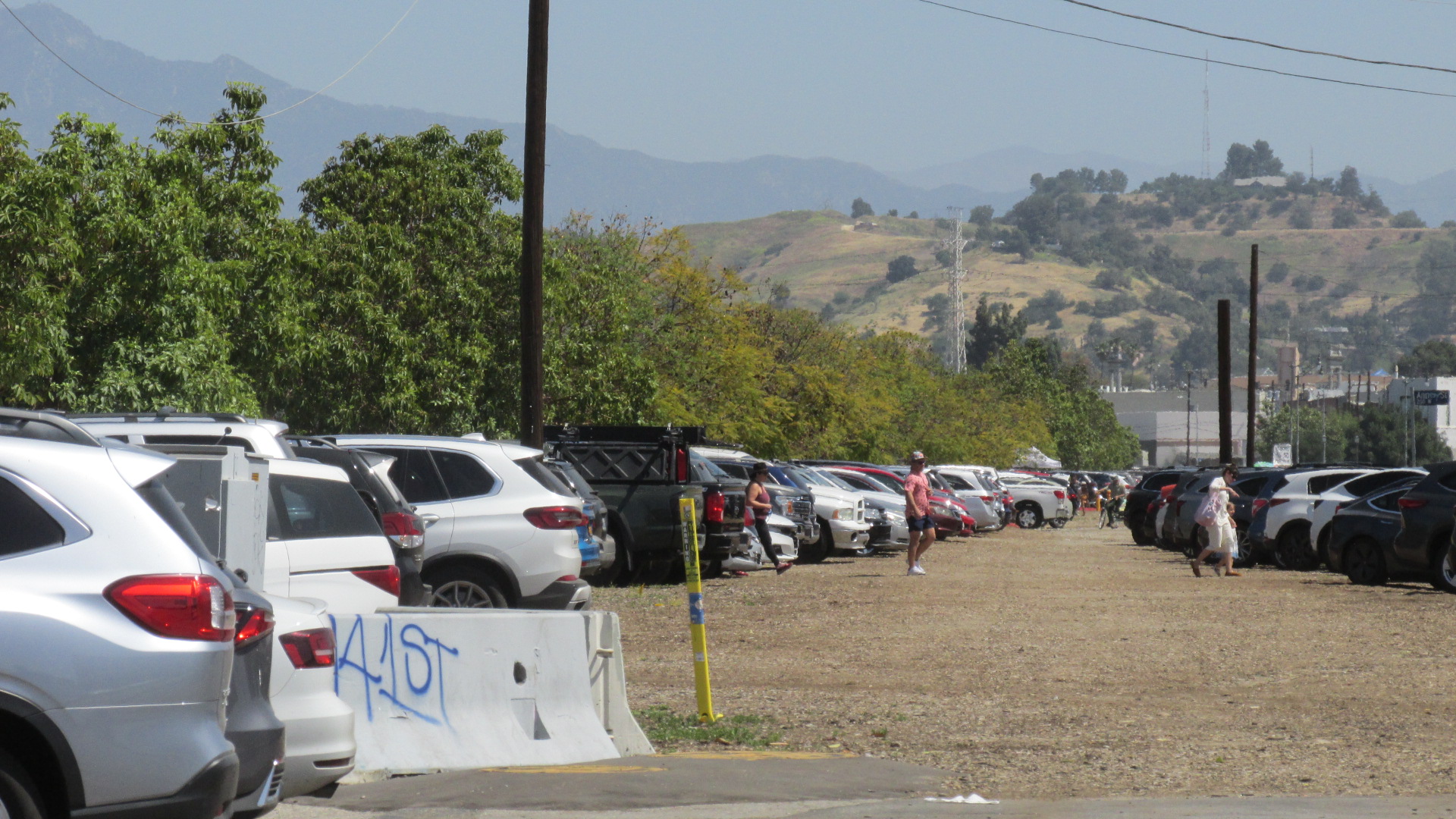
If you want to know how successful LA’s attempts at Transit-Oriented Development have been, take a look at the parking area next to the State Historic Park. It was packed with cars on the morning I was there. And Spring St., which is on the park’s perimeter, was also lined with cars.
Please note in the last photo above that the L Line (Gold Line) Station is visible in the background. I’m sure some of the folks who showed up at the park that day rode the train, but obviously a lot of people decided to drive instead, in spite of the fact that the station is just a few hundred feet from the park entrance.
LA City Planning talks a lot about revitalizing LA’s urban centers, but we need to ask what they actually mean by “revitalization”. The cost of renting an apartment Downtown makes it clear that living there is mostly for the affluent. While thousands of new units have been built in Downtown over the past decade, the vast majority of them are for the upscale crowd. The same is true citywide. According to LA City Planning’s Housing Progress Dashboard, of the more than 184,000 new units that have been approved since July 2013, only about 26,000, or 14%, have been for middle-income, low-income and very low-income households. To be clear, these three categories COMBINED make up just 14% of the new housing approved.
As I said before, the City has been successful in luring people to live in Downtown, and I’m glad of that. Looking at US Census data for the 90012 zip code, which covers much of central Downtown, it’s clear that the area has seen substantial growth. According to the American Community Survey (ACS), the population in 90012 has grown from 29,298 in 2011 to 37,268 in 2020.
Unfortunately, even as Downtown’s population has grown, ridership on transit lines serving the area has been dropping steadily. The graph below shows the changes in ridership on lines serving Downtown in 2014 and 2019. It includes all rail lines serving the area, but only selected bus lines.
You can see there’s been a significant drop. It’s important to point out that the biggest decline was on the A Line (Blue Line), and much of this was due to the fact that portions of the line were closed during 2019 for repairs and upgrades. (They didn’t do much good. Problems arose soon after the line re-opened.)
But even if we pull the A Line out of the chart, we still see a loss in ridership. If the City’s Transit-Oriented Development program is such a success, then why is transit ridership declining in Downtown, even as the population grows. (If you don’t trust my numbers, and you want to do your own research, visit Metro Ridership Stats. Under the heading Systemwide (Bus and Rail), click Details.)
I think the answer has to do with the kind of people who are moving to Downtown. While I hear a lot of hype about young urbanites who love walkable neighborhoods, the crush of cars I saw crowding around State Park leads me to believe that many of Downtown’s new residents own some kind of vehicle. Of course, that’s just my personal view based on my personal experience. To get a more accurate idea of how many Downtown residents are car owners, let’s take another look at the U.S. Census’ American Community Survey.
Looking again at the 90012 zip code, let’s check out the stats for vehicle ownership in 2011.
2011 ACS Data on Vehicles Available to Population in 90012 Workers 16 Years and Over in Households
No vehicle available 10%
1 vehicle available 42.9%
2 vehicles available 36.4%
3 or more vehicles available 10.7%
Now let’s look at the stats for 90012 in 2020.
2020 ACS Data on Vehicles Available to Population in 90012 Workers 16 Years and Over in Households
No vehicles available 6.6%
1 vehicle available 42.4%
2 vehicles available 40.0%
3 or more vehicles available 11.0%
You can see that the number of workers 16 years and over with no vehicle available dropped from 10% to 6.6%. The number with one vehicle available is basically unchanged. Those with two vehicles available went up from 36.4% to 40%. These are not huge changes, but they do show that percentages of workers 16 years and over with access to a vehicle has gone up, not down. And when we consider that the population in 90012 rose from 29,298 in 2011 to 37,268 in 2020, this seems to indicate that there are a lot more cars than there used to be in Downtown. Put this together with the drop in transit ridership, and it’s hard to understand why the City thinks its efforts at Transit-Oriented Development have been a success. (If you believe there are a lot more people walking and biking in the central city, feel free to show me the data. I’ve looked, and I can’t find anything less than six years old.)
I want to emphasize that I’m a transit rider and I don’t own a car. I also want to say that I believe we need to focus new development around transit hubs, in areas where jobs and businesses are close by. In theory all this is great. In reality, though, the City of LA doesn’t seem to have achieved anything. In fact, it seems like the numbers are going in the wrong direction. And if we’re going in the wrong direction, shouldn’t the City assess the situation, find out what’s wrong, and try to do better?
Unfortunately, rather than being used as a strategy to create a more sustainable city, Transit-Oriented Development seems to have become an excuse to approve residential projects that are far too expensive for the average Angeleno. I can’t tell you how many times I’ve been at hearings held by City Planning where staff and/or Commissioners claim that big, new residential projects geared toward the affluent are exactly what the City needs to get people out of cars and onto busses and trains. When I present data showing that transit ridership has been going down since 2014, they don’t seem to hear. I’ve never gotten a response. The projects are always approved.
I think the State Park is cool. I’m glad people are spending time there. But I don’t buy the story that young urbanites are ditching their cars for busses, trains and bikes. The cars lined up across the street from the park seem to tell a different story, one that City Hall doesn’t want to hear.
The water situation just keeps getting more dire. A brief recap: Last August the US Bureau of Reclamation (USBR) declared a Tier 1 shortage on the Colorado River, the first time it had ever taken this step. This was not good news for Southern California, which relies heavily on water from the Colorado. Then, in March of this year, California water officials announced that they’d be cutting allocations for the State Water Project (SWP) to 5% of requested supplies. Another blow to Southern California, which also gets much of its water from the SWP.
Things got even worse today, when USBR announced the first-ever Tier 2 shortage on the Colorado River. This will not affect California immediately, since the State has senior water rights, but the way things are going it’s likely that we’ll be impacted in the next couple of years. Scientists are predicting that the Western US will continue to get hotter and drier for the foreseeable future.
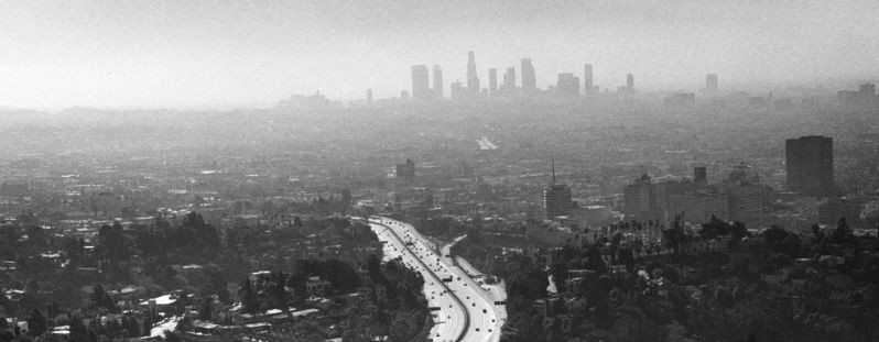
The City of LA is in especially bad shape. While some cities in Southern California have significant groundwater resources, Los Angeles’ supply is relatively small. In recent years, groundwater has made up about 10% of what we use annually. We do get water from the LA Aqueduct, but that’s not as reliable as it used to be, since snowpacks in the Sierra Nevadas have continued to decline in recent years.
Recycled water? LADWP has been talking about that for years. While there are big plans to reuse more of our water, right now recycling only accounts for about 2% of our supply. It will be years before that number grows much. Then what about desalination? It’s very costly, very energy intensive, and causes significant environmental impacts. There are other experimental processes out there, but nothing we can scale up quickly to replace what we’re losing from the SWP and the Colorado.
There are no easy answers. Scientists do not see a turning point in the near future. We’re going to have to learn to live with less water. This isn’t necessarily a bad thing. Over the past few decades, the City of LA has already cut its per capita water usage by quite a bit, and there’s still more we can do. But remember, we don’t know how far this trend is going. It’s likely we could learn to live with the level of water deliveries we’re getting now, but scientists predict that our snowpacks will continue to decline and our climate will continue to get warmer. We haven’t seen the worst yet.
I have to say, the older I get, the more I question the wisdom of building a city of 4 million people in a place with such limited water resources. People talk about how Hoover Dam and the State Water Project were great accomplishments, and yeah, in a way they were. But as the water level in Hoover Dam continues to decline, as the State Water Project continues to suck the life out of the Sacramento-San Joaquin Delta, I have to wonder where this is all going.
Right now, it doesn’t look good.
Here’s an excellent breakdown of the current situation from CalMatters.
The City of Los Angeles couldn’t exist without the water it imports from sources far beyond its borders. While the ratios vary widely from year to year, on average we get about 10% of our annual supply from groundwater within the city limits. The remaining 90% has to be imported from places hundreds of miles away.
Which means we really should pay attention to the Water Supply Alert issued by the Metropolitan Water District (MWD) on August 17. The entire State of California, and in fact much of the Western US, is experiencing extremely dry conditions. At this point the MWD is asking for citizens, businesses and public agencies to make voluntary reductions, but there’s a good chance that stricter measures will be needed in the not too distant future. Through careful planning and good stewardship, the MWD has managed to build up significant reserves which might provide a buffer for the next year or two. But we can’t be complacent. This year the California Department of Water Resources has cut allocations from the State Water Project to just 5% of requested supplies. It’s possible that next year the allocation could be reduced to zero. On top of that, for the first time ever, the Bureau of Reclamation has declared a shortage on the Colorado River. Lake Mead supplies much of the water that Southern California relies on, and storage there has been declining faster than even the most pessimistic observers predicted. Right now the water level is lower than it’s been at any time since Hoover Dam was constructed.
Which leaves us with the LA Aqueduct. At the beginning of the 20th century, Los Angeles business leaders were working hard to promote the city’s growth, but they knew that the area’s water resources were limited. In looking for solutions to this problem, they set their sights on the Owens Valley, over 200 miles away. Using secretive and dishonest means, the City of LA managed to purchase rights to much of the water in the Owens Valley, and then began construction of the LA Aqueduct under the supervision of William Mulholland. In LA the completion of the Aqueduct was hailed as an engineering marvel, and for a time Mulholland was celebrated as a hero. Needless to say, the people of the Owens Valley didn’t see things quite the same way. For them, the diversion of water resources to the Aqueduct resulted in disastrous environmental impacts, and set the stage for decades of litigation.
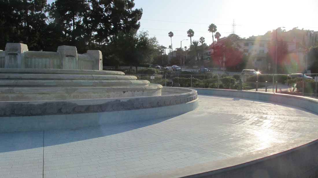
Mulholland Memorial Fountain from DWP Photo Collection at LA Public Library
In 1940, five years after Mulholland’s death, a fountain was built at the intersection of Los Feliz Boulevard and Riverside Drive to honor the man primarily responsible for the construction of the LA Aqueduct. The choice to create a fountain was considered a fitting way to commemorate the role Mulholland played in securing the water that was necessary for the city’s growth. For decades cool, crystalline plumes arched into the air and cascaded into the rippling pool below.
Today the fountain is dry and it’s surround by a chain link fence. While a search on the net didn’t reveal any explanation, it seems likely that LADWP shut it down in response to the looming water shortage. This is certainly a sensible step to take, but it should also raise questions about LA’s future. Mulholland was celebrated because of his efforts to provide water that would support the city’s growth. If the fountain is now dry, maybe this should be a cue to start asking how much LA can realistically grow in the future?
While government officials and the media routinely describe the situation as a drought, I don’t think that’s accurate. In fact, I think it’s seriously misleading. “Drought” is generally defined as a prolonged period of dry weather. This implies that at some point the drought will end and things will get back to normal. But there’s growing evidence that this is the new normal. Both the State Water Project and the LA Aqueduct are fed by snowmelt from the Sierra Nevadas. The Sierra snowpacks have been declining for years, and climatologists predict that they’ll continue to decline for the foreseeable future. As for the Colorado River, California, Nevada and Arizona draw more water from this resource than it can deliver on an annual basis. The construction of Hoover Dam masked this fact for decades, but the rapid decline of Lake Mead should be a wake-up call for all of us. Right now it seems inevitable that water allocations to all three states will have to be reduced, but this will be a long, contentious, brutal process.
So if all of the city’s water resources are declining, our public officials need to let go of the myth that LA can keep growing forever. LA’s 2020 Urban Water Management Plan (UWMP) assumes that all it will take is more stormwater capture and a concerted effort to conserve. Unfortunately, stormwater capture doesn’t really work when you’re hardly getting any rain. And while Angelenos have shown a willingness to save water in the past, current forecasts seem to indicate that we’d have to push conservation to a whole new level. The more you cut, the harder it is to cut further. The UWMP’s conservation projections are extremely optimistic. It’s hard to say whether they’re realistic.
The Mulholland Memorial was intended as a monument to the man who oversaw the construction of a massive infrastructure project that allowed the city to grow rapidly. In the state it’s in now, it seems more like a monument to the folly of those who believed you could build a city of 4,000,000 people in an area with minimal water resources.