A Patch of Green in the Grey

LT X05 Pl Trees

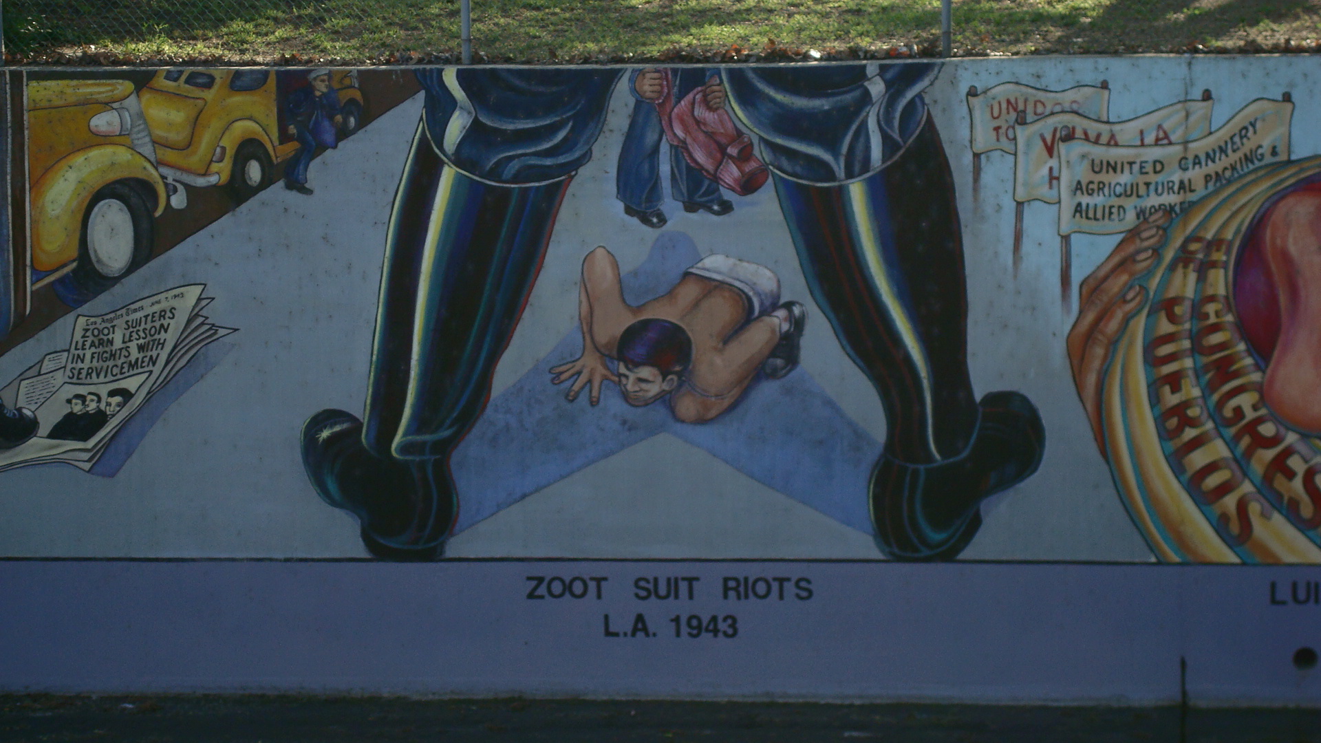
Week before last I went downtown to attend a meeting at City Hall. When I got there, the room was packed. It was hard to even find a seat. The zoning administrators started off with the obligatory preliminaries, which went on for quite a while. I looked around me and realized that there were dozens of people besides me who wanted to speak. I knew I was in for a long, dull morning.

So I split. They didn’t need me, and it seemed crazy to sit there waiting for a chance to talk when I knew there were other people who would cover everything I had to say, and probably say it better than I could. I decided to grab some breakfast and find a quiet place to chill. I got some food and some coffee and headed over to the plaza by the Japanese American Cultural & Community Center (JACCC).

LT X10 Pl Guys

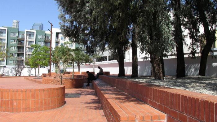
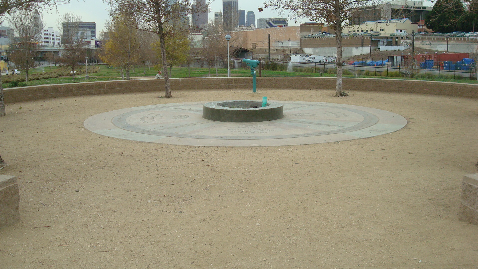
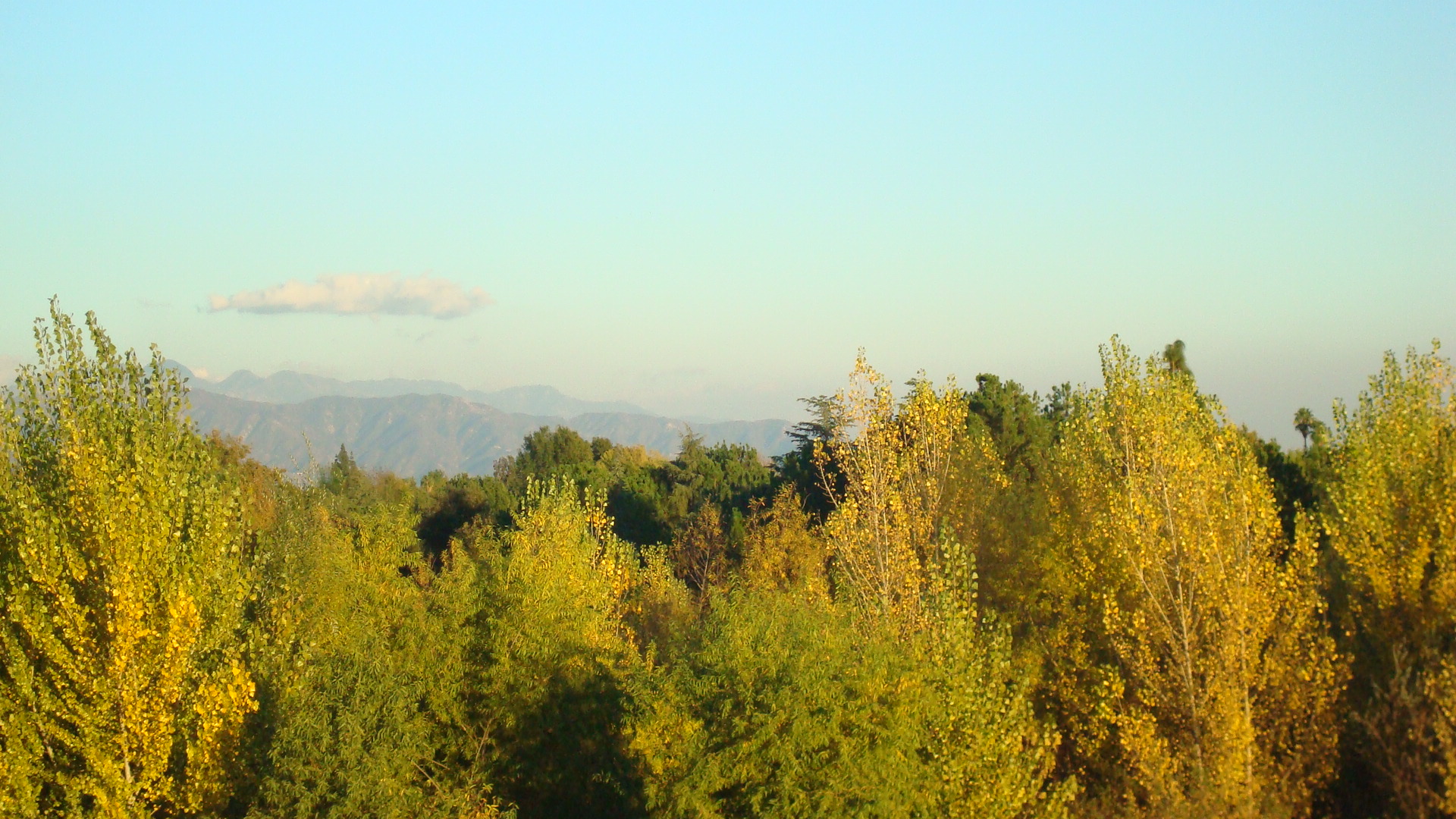
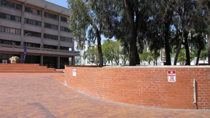
I love to hang out there. It’s spacious and usually pretty peaceful. Unless there’s an event going on, it’s unlikely you’ll find more than a handful of people on the plaza. One side is shaded by tall trees.

Opposite me I could see people coming and going at the JACCC. They do a lot of interesting programming. They even offer ukulele lessons.*

LT X12 Pl Uk

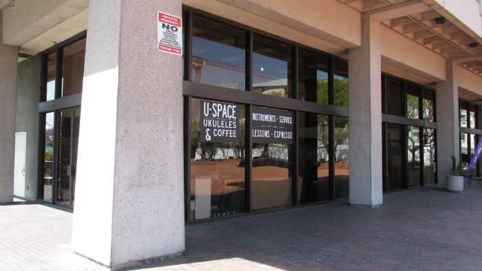
Take a look at the web site to find out about upcoming events.

JACCC

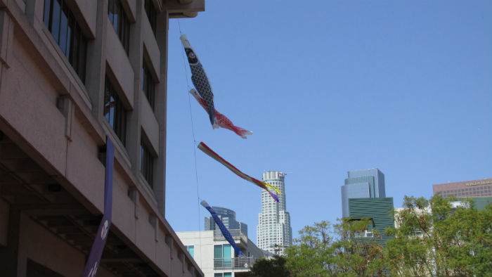
I spent a while looking at the kites on the west side of the building, as they rose and fell with the breeze.

LT X15 Pl Kites

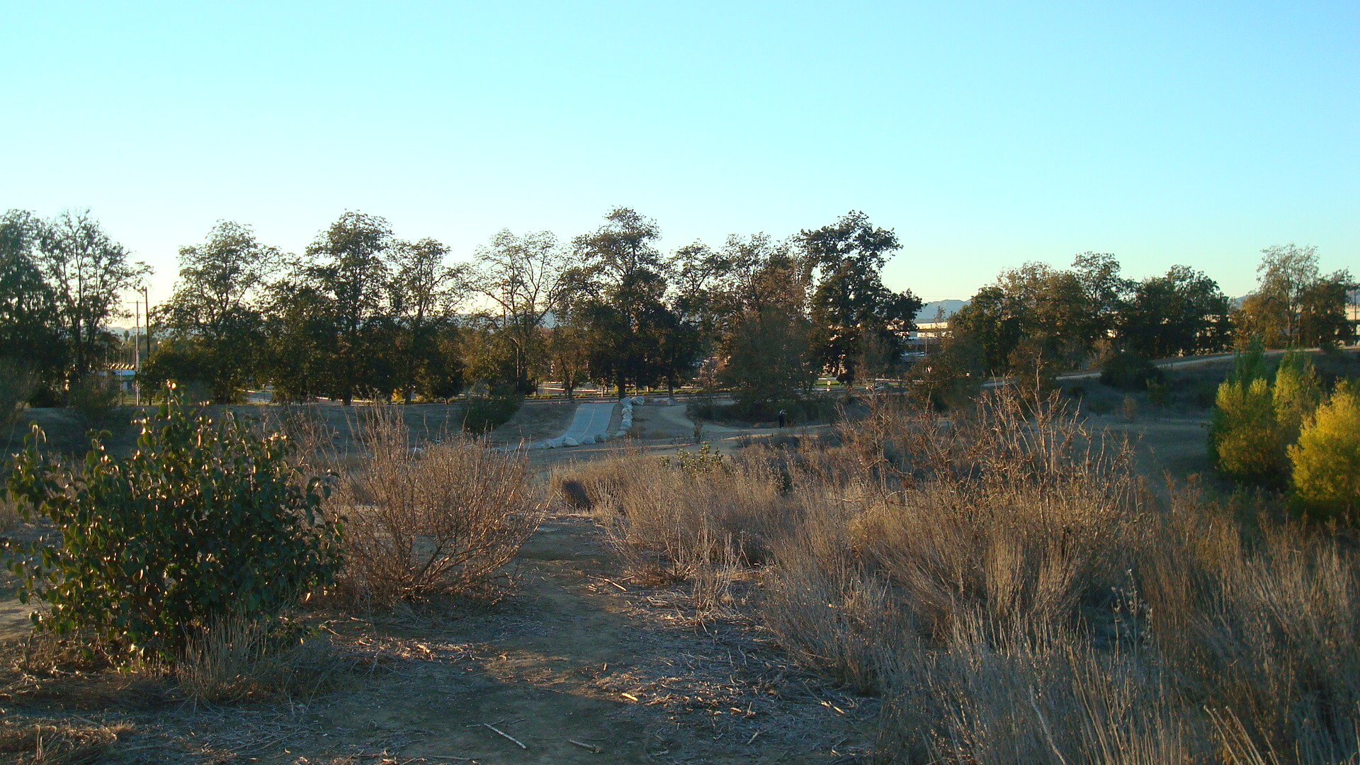
Then I was ready to go. But as I was leaving I saw a grove of trees off to one side. I’d never really noticed them before, so I walked over to take a closer look.

LT X25 Pl Gdn Trees View

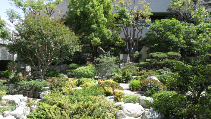
And as I neared the trees, I realized that they were part of a garden that rested just below the level of the plaza.

LT X30 Gdn Wide

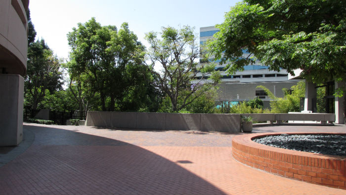
As I stood there by the locked gate, an elderly woman walked past and told me that the garden was open to the public. All I had to do was go to the JACCC and sign in. So that’s what I did.

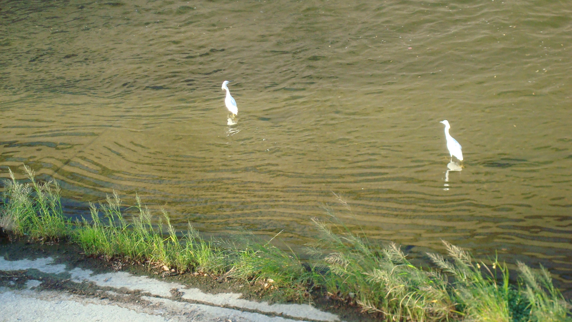
It was so cool to discover this peaceful patch of green in the middle of downtown. I walked around snapping photos and enjoying the quiet.

LT X45 Gdn Path

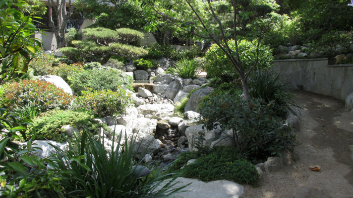
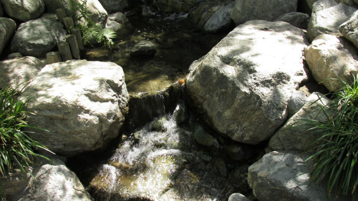
I’m sure the sound of traffic was all around me, but I was more focussed on the sound of the stream that runs through the middle of the garden. I would’ve loved to spend a while just sitting on a rock and gazing into the water. Unfortunately, I had other stuff to do, so I moved on after about fifteen minutes. But I will be back.

LT X50 Gdn Water

*
In surfing the net, I noticed this comment by a woman who’s apparently a regular at the JACCC. “It is ukulele heaven in DTLA.” An amazing claim, which I can’t verify. You’ll have to check it out yourself.

Legalize Sleep

DSC08124

Demonstrators on the steps at Pershing Square.

There were a number of actions planned for this weekend to coincide with Martin Luther King’s birthday. I had heard that Black Lives Matter was holding a vigil downtown, and so I hopped on the Red Line and got off at Civic Center. But it turned out the vigil was over, and so I was standing there on First Street wondering what to do next.  Fortunately, I ended up running into a group of people who were demonstrating to protect the rights of the homeless. They were marching through downtown on their way to Pershing Square. I met up with them when they made a stop on Fifth Street.

DSC08112

The group stops to hear a speaker on Fifth Street.

One of the major points the speakers made is that our government is trying to control and restrict the use of public space. This affects the homeless in that they aren’t allowed to sleep in parks or on sidewalks, but really it affects all of us. Public space is an essential part of civic life. Our elected officials are putting more and more restrictions on the way public space is used, often for the benefit of business interests. The whole idea of public space is that it’s for everyone, not just those that our elected officials deem worthy.

The reason that homeless people end up sleeping in parks is they have nowhere else to go. The Mayor and the City Council are bending over backwards to help developers build luxury residential towers, while affordable housing gets harder and harder to find. Affordable units are being demolished or converted to condos so that property owners can make an even bigger profit. This will only increase the number of people living on the streets.

DSC08126

Protesters walking through Pershing Square.

So you’ve been kicked out of your apartment because the landlord hit you with a huge rent increase. You can’t sleep on the sidewalk. You can’t sleep on bus benches. And you can’t sleep in the parks. Where do you go? Our elected officials don’t seem to care. They’re too busy granting variances for the developers who’ve been giving them campaign cash.

The affordable housing crisis in LA is getting worse. We need to address it. Instead of racing to build high-end residential skyscrapers, we need to be creating housing for all the people of Los Angeles. Everybody deserves a safe place to sleep.

DSC08134

My favorite slogan from the demonstration.

Transformations

TW 00 GW Campus

Around the middle of the twentieth century, over a period of decades, the LA County Flood Control District did their damnedest to encase most of the city’s waterways in concrete. Apparently it seemed like a good idea at the time. From our contemporary perspective, it looks like a colossal mistake. But what can we do? We don’t have the means to break up the hundreds of miles of concrete that were poured back in the last century. So we’re doing what we can, getting behind small projects that we hope will eventually have a cumulative impact.

I’ve lived in LA all my life, and it still amazes me how little I know about this city. The Tujunga Wash runs from the San Gabriel Mountains, across the San Fernando Valley and feeds into the LA River around Studio City. Recently I started paying attention to the stretch that runs along Coldwater Canyon between Burbank and Oxnard. What I found was pretty interesting.

Above Oxnard, I found the Tujunga Wash Greenway and Stream Restoration Project. What used to be a drab stretch of land running alongside a drab stretch of concrete has been transformed into a lush green walkway which helps to replenish our groundwater.

TW 02 Green

For a better explanation than I could give, click on this link to a page at the Landscape Architecture Foundation. They also provide before and after pictures to give you a sense of how dramatic the change has been.

Tujunga Wash Greenway

TW 04 Green Bed

Below Oxnard, I found the Great Wall of Los Angeles. This is a massive, amazing public art project which presents a history of Los Angeles starting with the first people who lived in the area and ending in the fifties. The project is the brainchild of Judy Baca, founder of the Social and Public Art Resource Center (SPARC). It was begun in the seventies, with over 400 young people and their families working over five summers to create the mural that currently covers a half mile of concrete inside the Tujunga Wash.

The mural starts with images of the Chumash Indians.

TW 06 GW Chum

It covers the construction of the the massive projects that helped build the city, like the railroads….

TW 07 GW Chin

….and the aqueduct.

TW 09 GW Aque

It illustrates the multiple waves of migration the populated the area.

TW 09a GW Dust Big

There are images of the traumatic upheavals that shaped LA.

TW GW Zoot

It takes us through the baby boom….

TW 11 GW BB

….and the beginnings of rock n’ roll.

TW 12 GW  R&R

There are plans to paint another four decades, which would bring the project up to the end of the twentieth century. For more information, and to find out how to donate, visit SPARC’s web site.

The Great Wall of Los Angeles

You won’t find much water in the Tujunga Wash these days. But you will find some other things that are worth checking out.

The Cornfield Under Construction

The Cornfield on a day in January.

The Cornfield on a day in January.

You may not be familiar with Los Angeles State Historic Park, AKA the Cornfield. Downtown residents probably know it best, though it’s also hosted a number of popular music festivals. It is kind of off the beaten path, lying on the outskirts of the downtown area, and it’s only been around since two thousand five.

The entrance to the Cornfield.

The entrance to the Cornfield.

Unfortunately, if you haven’t made it down there yet, you’re going to have to wait until next year. Plans to expand and improve the site have been on the drawing board for a while, and the state has finally approved the funds. So the park will be closing this month as work begins. Among the changes will be the creation of a wetlands area, the construction of an amphitheatre and the addition of a space for a farmers market.

I actually like the park as it is, a plain, open space with grass and trees. So I decided to take some photos of it before the closure. The park was pretty empty on the day I made it down there, probably in part because the sky was overcast.

Downtown is visible off in the distance...

Downtown is visible off in the distance…

...and industrial area lies on one side...

…an industrial area lies on one side…

...and train tracks on the other.

…and train tracks on the other.

The site that the park is on has a pretty interesting history. Community groups fought with a developer who wanted to build warehouses on the land. This article on the KCET web site offers a good deal of information. The designers who created the park’s current state incorporated markers to commemorate some of the groups that have been a part of LA’s history.

The path leading up to a low hill...

The path leading up to a low hill…

...where you'll find a concrete marker...

…where you’ll find a concrete marker…

...that commemorates some of the people who make up the city's history.

…that commemorates some of the people who make up the city’s history.

Creating the park was a long and difficult process, and there were disagreements among some of the groups involved. This article from the LA Times covers the conceptual art event that re-opened the park, and also details some of the differing points of view.

Not a Cornfield

And for the official story (much less interesting), you can take a look at the state’s web page.

Los Angeles State Historic Park

Corn 10 Hill w Trees

A Day in the Park

Late afternoon in Barnsdall Park.

Late afternoon in Barnsdall Park.

Years ago I used to live on Edgemont between Hollywood and Sunset. One of the great things about the neighborhood was that Barnsdall Park was right across the street. I used to go there fairly often, but then I moved away, and Barnsdall kind of fell off my radar. I’ve been meaning to go back for years, and this last weekend I finally made the trip.

A cyclist resting at the base of the hill.

A cyclist resting at the base of the hill.

There are lots of parks in urban areas, but somehow Barnsdall seems different. I think this is mostly because it sits on top of a hill. As you climb the stairs, the sounds of the city, the traffic, the sirens, the helicopters, all seem to fade into the background. Then you get to the top and there are these amazing panoramic views of Los Angeles.

The Griffith Observatory is perched on the hills opposite Barnsdall Park.

The Griffith Observatory is perched on the hills opposite Barnsdall Park.

Another reason the park is special is that it’s home to Frank Lloyd Wright’s Hollyhock House. Completed in nineteen twenty three, this was Wright’s first project in Los Angeles. I’ve only been inside once, but the memory has stayed with me. The house is beautiful and unique. Unfortunately, it’s closed right now for restoration.

The entrance to Hollyhock House.

The entrance to Hollyhock House.

A view of Hollyhock House.

The west end of Hollyhock House.

Hollyhock House's central courtyard

Hollyhock House’s central courtyard.

We have the park thanks to the generosity of Aline Barnsdall, who donated it to the city back in the twenties. Originally from Pennsylvania, Barnsdall wanted to create a theatrical community on what was then known as Olive Hill. She commissioned Wright to design Hollyhock House, as well as several other structures, but the two parted ways and the complete plan was never realized.

The Municipal Art Gallery at Barnsdall Park.

The Municipal Art Gallery at Barnsdall Park.

Barnsdall Park is also home to the Municipal Art Gallery and the Junior Arts Center. For more information on the programs offered, follow the link below.

Barnsdall Art Park

And if you’d like more information on Hollyhock House, click here

Hollyhock House

People on the grass at the western edge of the park.

People on the grass at the western edge of the park.

How to Find the LA River

A view of the LA River in the late afternoon

A view of the LA River in the late afternoon

When I was a kid growing up in Burbank the LA River was a joke. It wasn’t a river at all. It was a huge concrete aqueduct with a tiny trickle of water running down the middle of it. Occasionally after heavy rains the water level would rise for a day or two. But it was nothing like the majestic waterways that flowed through other cities. It seemed like some kind of weird, synthetic excuse for a river, and it seemed perfectly in keeping with the image many people had of a LA as a weird, synthetic excuse for a city.

The LA River near Warner Bros. studios in Burbank

The LA River near Warner Bros. studios in Burbank

But over the years I’ve been hearing more and more about efforts to rethink the river. I understand now how important the LA River once was to the city, and I’m slowly beginning to realize how important it could be to LA’s future.

Back in the eighteenth century it was the source of water for the small settlement originally called El Pueblo de Nuestra Señora la Reina de Los Angeles. The river continued to provide most of LA’s water until the twentieth century, when the Owens Valley Aqueduct and the Colorado River Aqueduct were built. In the thirties, after a series of devastating floods, it was decided that the best thing to do with the LA River was encase it in cement. The US Army Corps of Engineers took charge, supervising one of the largest public works projects in US history. When it was done, the river had been transformed into a massive concrete channel.

But over the past twenty years or so, a growing number of people have been looking for ways to reclaim the river, to once again make it a vital part of the life of Los Angeles. It flows from Canoga Park across the Valley to the Glendale Narrows, and then winds through Downtown and continues all the way to Long Beach. In making that trip it is one of the few unifying factors in a city where residents often feel they have no connection to each other. It has the potential to become a vast linear park, winding its way through many of LA’s neighborhoods, providing a space where people could relax, enjoy themselves and connect with nature.

Lush greenery along the river as it runs through Griffith Park

Lush greenery along the river as it runs through Griffith Park

There are many groups involved in the effort to remake the river, but the one that’s been around the longest is Friends of the LA River.

FoLAR

If you’re interested in getting involved, there’s probably a group in your neighborhood that could put you to work.

A while ago I started taking photos of the river. It was an interesting exercise. I found that while the river has been there all my life, and I’ve crossed it at one point or another every day for decades, I’ve never taken the time to look at it. How many times did I drive past Balboa Park without ever realizing that the LA River runs right through it. I lived in Silverlake for a few years, and used the Hyperion Bridge regularly, but I never looked down to see what was below. And I’ve crossed the bridges east of downtown LA a million times, rarely pausing to take more than a glance at the river running underneath.

So if, like me, you haven’t paid much attention to the LA River, maybe you should take a walk down to the banks some time. You might be surprised at what you find.

Trees crowded around the river in Balboa Park

Trees crowded around the river in Balboa Park

Another shot of the park facing toward Balboa Blvd.

Another shot of the park facing toward Balboa Blvd.

Ducks on the river in Sherman Oaks

Ducks on the river in Sherman Oaks

More birds on the river as it flows through Sherman Oaks

More birds on the river as it flows through Sherman Oaks

Another shot of the river on the edge of Griffith Park

Another shot of the river on the edge of Griffith Park

Facing west on the outskirts of Griffith Park

Facing west on the outskirts of Griffith Park

A mural marking a tiny, but cool, park in the Glendale Narrows

A mural marking a tiny, but cool, park in the Glendale Narrows

The Glendale Narrows, just below Atwater

The Glendale Narrows, just below Atwater

The river flowing past the railyards at the edge of Downtown LA

The river flowing past the railyards at the edge of Downtown LA

The river heading out of Downtown LA, on its way to Long Beach

The river heading out of Downtown LA, on its way to Long Beach